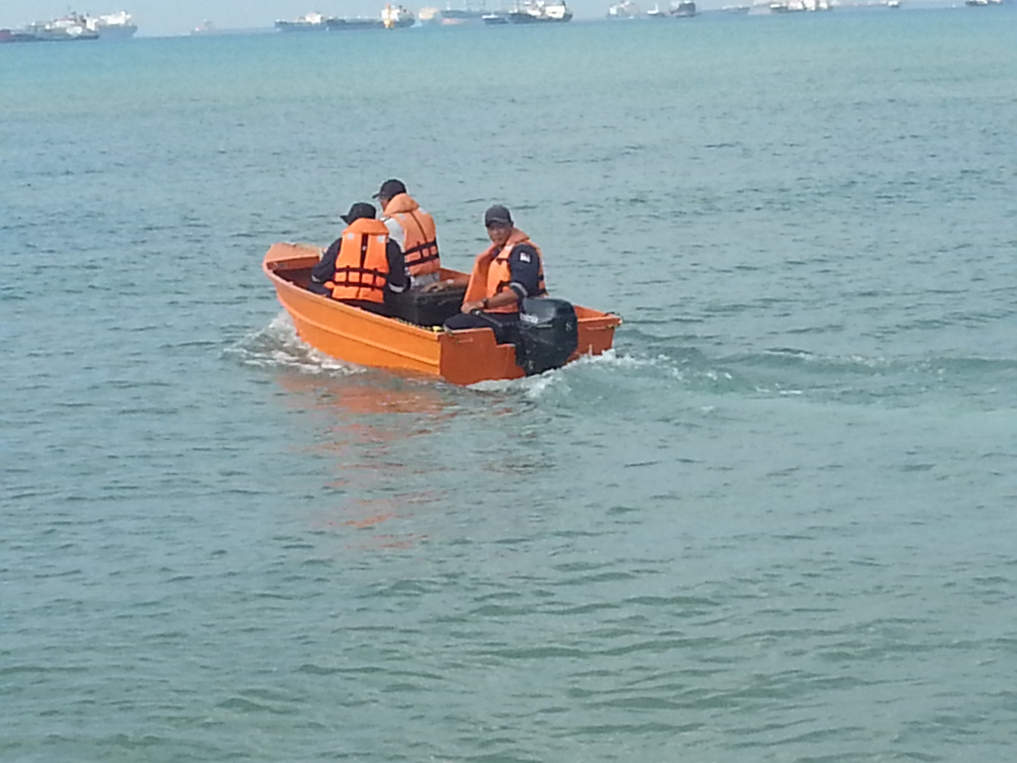
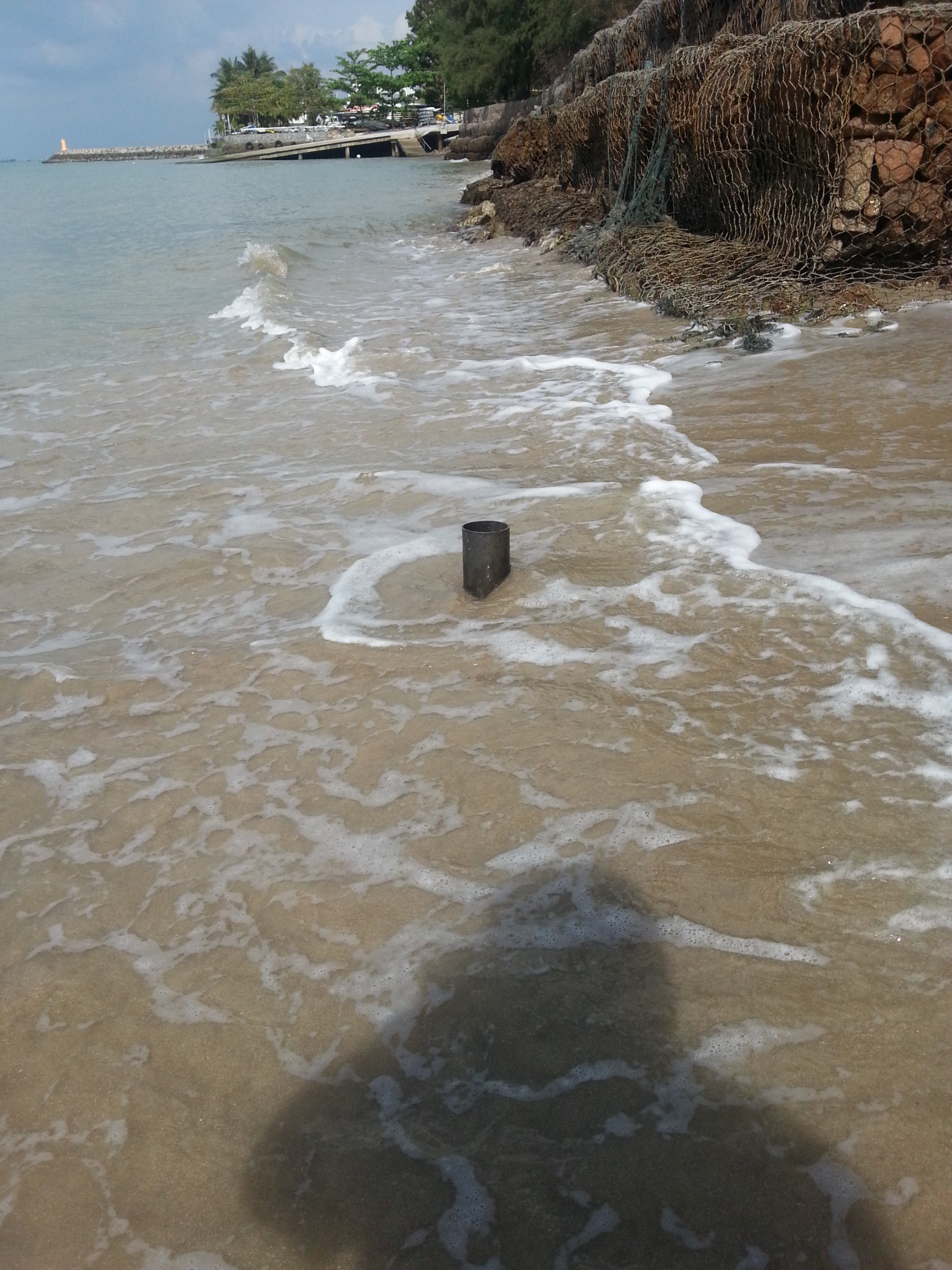
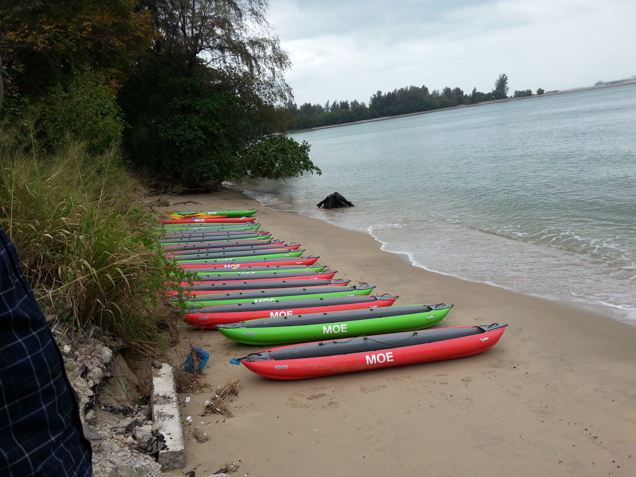
BAYPORE-SINGAPORE has the capacity to measure a variety of oceanographic and meteorological variables for commercial or research purposes. We use state-of-the-art equipment based on industry specifications. Oceanographic variables can be measured in a variety of marine environments, ranging from coastal areas to the deep-sea. Meteorological measurements are collected in the onshore and offshore environments.
Our systems collect in-situ data, which is either stored in a logger for later use or made available in near-real-time. The real-time data are transmitted to receivers via remote mobile data telemetry.
The measurements of currents, waves, water level and various meteorological and water quality parameters are conducted during field campaigns and the data is processed.
BAYPORE provides various marine environmental services to clients engaged in coastal and offshore construction and development. We have experience providing such services for clients for coastal property development and soil erosion mitigation programs. We follow scientific methodology using advanced modelling software like Mike 21 of DHI.
BAYPORE conducts Environmental Impact Assessments (EIAs) for the marine and coastal components of a variety of activities associated with coastal and offshore developments. Our work is based on a scientific approach, taking into account socio-political aspects, while ensuring compliance with local and international environmental laws and regulations.
We have comprehensive Environmental Management & Monitoring Programme (EMMP)in which the site will be continuously monitored, assessed and forecast the details if there is a change in the system status.
EIA components:
- Definition of the ecological conditions in the project area by sampling and measurement and a desktop review of available information.
- Identification of ecological sensitivities that may be affected by the implementation of the project.
- Development of control and mitigation strategies by which the client may avoid or lessen the potential impact of the project on the environmental receptors.
- Development of an effective Environmental Management Plan (EMP).
- Met-Ocean data processing & analysis
- Wind, waves, tides & currents
- Water quality parameters
- Numerical Modelling
- Wind-waves
- Coastal Hydrodynamics
- Water Quality Modelling
- Dredging & Reclamation
- Sediment/Mud Transport
- Beach Stability
- Wave disturbance in harbours
- Extreme values analysis
- Estimation of return periods
- Design basis & Operational downtime assessment
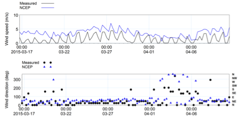
Measurements of met-ocean data such as wind, wave, tides, currents and water quality parameters are essential in understanding the characteristics of those parameters and to assess its impact on the coastal environment. Meteorological data are usually collected using Autonomous Weather Stations, while instruments such as Wave Rider Buoys, Tide Gauges, ADCP and Sensors are deployed for oceanographic data collection. The time-series as well as transect data will be processed and analysed.
Please contact us for DAVIS Meteorological Weather Station. Unit is available on rental.
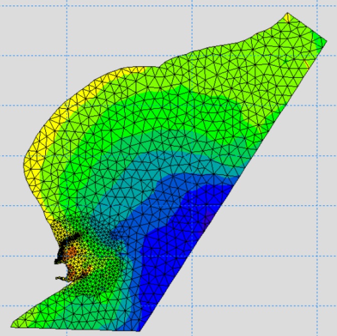
Coastal developments such as Ports & Harbours, Reclamation, and Desalination Plants require detailed assessment of the coastal oceanographic phenomena. In situ measurements sometimes are inadequate to represent the fine grid details of the phenomenon, though they can be used for validations. Numerical models are adequate to compute the various parameters with desired resolutions over a wide domain. Commercial models such as MIKE 21 (two-dimensional) and MIKE 3 (three-dimensional) are widely used for the computation of coastal oceanographic phenomenon such as wind-waves, currents, flushing, thermal & brine dispersion, sediment transport and littoral drift & beach erosion.
Estimation of return periods for the wind, wave and sea level is necessary for the design of coastal and offshore structures. The long-term data obtained from re-analysis / satellite data sources such as NCEP, ERA will be analysed using probability distributions. The desired parameters will be extrapolated to various return periods (50 year, 100 year etc.).
The design basis for the structures such as 100 year return period wind, wave and sea level at the proposed locations will be estimated based on the extrapolated and numerical modelling results.
Estimation of operational downtime is important for the loading/unloading of ships, dredging & reclamations etc. This will be estimated based on the long-term data as well as using the numerical modelling results.
We use a third generation spectral wind-wave model, MIKE 21 SW DHI Water & Environment, Denmark (DHI, 2012c) to simulate the wind-waves. The model simulates growth, decay and transformation of wind-generated waves and swells in offshore and coastal areas. MIKE 21 SW includes the following physical phenomena:
- Wave growth by action of wind
- Non-linear wave-wave interaction
- Dissipation due to white-capping
- Dissipation due to bottom friction
- Dissipation due to depth-induced wave breaking
- Refraction and shoaling due to depth variations
- Wave-current interaction
- Effect of time-varying water depth and flooding and drying
The discretization of the governing equation in geographical and spectral space is performed using cell-centered finite volume method. In the geographical domain, an unstructured mesh technique is used. The time integration is performed using a fractional step approach where a multi-sequence explicit method is applied for the propagation of wave action.
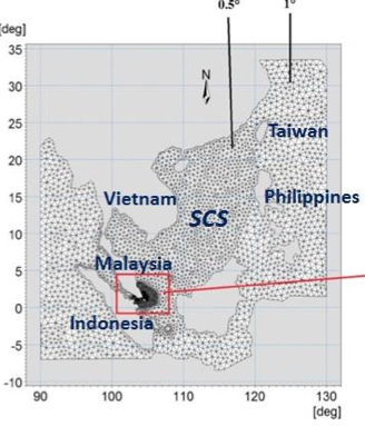
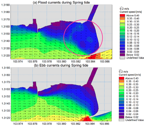
MIKE 21 HD, a flexible mesh hydrodynamic model DHI Water & Environment, Denmark (DHI, 2012a; 2012b) has been used to simulate the currents and water levels. The Hydrodynamic Module is the basic computational component of the entire MIKE 21 Flow Model FM modelling system providing the hydrodynamic basis for the Transport Module, ECO Lab/Oil Spill Module, Mud Transport Module, Sand Transport Module and Particle Tracking Module. The modelling system is based on the numerical solution of the two- dimensional shallow water equations – the depth-integrated incompressible Reynolds averaged Navier-Stokes equations. The spatial discretization of the primitive equations is performed using a cell-centered finite volume method. The spatial domain is discretized by subdivision of the continuum into non-overlapping element/cells. In the horizontal plane an unstructured grid is used comprising of triangles or quadrilateral element. An approximate Riemann solver is used for computation of the convective fluxes, which makes it possible to handle discontinuous solutions.
The MT model includes the following processes:
- Multiple mud fractions
- Wave-current interaction
- Flocculation and settling
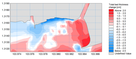
- Morphological calculations
The sediment transport formulations are based on the advection-dispersion calculations in the Hydrodynamic model.


